Thursday, May 31, 2018

Prince Edward Island


Earlier this month we traveled to Prince Edward Island for vacation. On this blog are nine posts about our travels:
We traveled by car. Nancy had been to PEI once about 50 years ago, before Confederation Bridge was built. I had never been.

About a year ago, we took a similar vacation to Nova Scotia. On both trips, we traveled through New Brunswick and spent time exploring the exceptional Bay of Fundy.

All of the Canadian Maritime provinces are wonderful places, and we highly recommend visiting.

One of the things that Prince Edward Island is noted for is potatoes. Here is something that I learned about potatoes from a sign at the Canadian Potato Museum in O'Leary, PEI:

Father of the American Fry?

Thomas Jefferson, Third President of the United States, author of the Declaration of Independence, a Founding Father of the Republic, is also credited with bringing the French fry to North America. He encountered deep fried potatoes while serving as Ambassador to France in the 1780s and introduced the crop to his garden when he came home. While serving as President he had "potatoes cooked in the French manner" served at official dinners.

Wednesday, May 30, 2018

Tidal Bore

A tidal bore is when the incoming tide in a tidal river is large enough and fast enough to create one or more waves moving upriver.

I had never heard of a tidal bore until our vacation last year in Nova Scotia. There are not many rivers in the world that experience a tidal bore; there are none in the northeastern United States. On rivers that do have a tidal bore, they occur on the same schedule as the tides, about every 12.5 hours.

Below is a 40-second video of a tidal bore that I took last year in Truro, Nova Scotia, on 5/29/17:


We watched another tidal bore today in Moncton, New Brunswick. Below is a 40-second video that I took this morning:


Note the two blue herons that fly away as the leading wave approaches.

This map shows the two locations, both in rivers that flow into the upper parts of the Bay of Fundy:


Well, the rivers flow into the Bay of Fundy except when the tide makes the water flow the other way!

The tidal bore that we watched today in Moncton was on the Petitcodiac River. I was standing next to the covered pedestrian bridge on the Riverfront Trail that I wrote about in my earlier post titled Bridges.

Monday, May 28, 2018

North Cape


The North Cape of Prince Edward Island is home to a lighthouse, eroding red cliffs, the longest natural rock reef in North America, a nature trail, and wind turbines:


The birds on the rock reef above are Eider ducks.

The North Cape Interpretive Centre was closed "until further notice" and without explanation, but we enjoyed a hike today on the Black Marsh Nature Trail. The trail goes along the tops of the cliffs, through scrub woodlands, and among wind turbines on its way to the Black Marsh. Most of the photos above are from this trail. Also from the trail:


Two interesting features in the photo above: the remains of Elephant Rock sticking up out of the ocean, and dead tree roots sticking out of the eroding bank.

The Wind Energy Institute of Canada is located on the North Cape. In addition to WEICan's research and development facilities, there are two wind farms on the North Cape. The North Cape Wind Farm consists of 16 Vestas V-47 turbines installed in 2001 and 2003. These turbines are mounted on 50 meter towers, with 23 meter blades, and a rated output of 660 kilowatts each. The selfie photo above is under one of the V-47 turbines. The Norway Wind Park consists of nine Vestas V-90 turbines installed in 2007. These turbines are mounted on 80 meter towers, with 45 meter blades, and a rated output of 3 megawatts each. Click here for more information about wind energy in PEI.

Our travels to and from the North Cape took us on the North Cape Coastal Drive. The signs along the road referred to this area of Prince Edward Island as the "Canadian Oyster Coast." We stayed at Mill River Resort, which was in the midst of major renovations. Before leaving northwestern PEI, we visited the Canadian Potato Museum.

Sunday, May 27, 2018

Anne of Green Gables


Anne of Green Gables was published in 1908. From Wikipedia:
Set in the late 19th century, the novel recounts the adventures of Anne Shirley, an 11-year-old orphan girl who is mistakenly sent to Matthew and Marilla Cuthbert, a middle-aged brother and sister who had intended to adopt a boy to help them on their farm in the fictional town of Avonlea on Prince Edward Island. The novel recounts how Anne makes her way with the Cuthberts, in school, and within the town.

The book was an immediate success, and author Lucy Maud Montgomery (1874-1942) became famous. From Wikipedia:
The first novel was followed by a series of sequels with Anne as the central character. Montgomery went on to publish 20 novels as well as 530 short stories, 500 poems, and 30 essays. Most of the novels were set in Prince Edward Island, and locations within Canada's smallest province became a literary landmark and popular tourist site.

We saw references to "Anne of Green Gables" all over central PEI.

Lucy Maud Montgomery drew on her life growing up in PEI for material for her books. She was born in New London, PEI but moved to the neighboring town of Cavendish when 21 months old to be raised by her maternal grandparents, Alexander and Lucy Macneill, following the death of her mother. The Macneills ran the Cavendish post office. Avonlea is based on New London and Cavendish.

The house and farm in the photo above belonged to David and Margaret Macneill, cousins of Montgomery's grandparents. The farm, also in Cavendish, was a short distance from where Montgomery lived with her grandparents. She often walked between the two properties, as did we when we visited on May 25. Although she wrote at home, the house and farm above – now part of PEI National Park – were the inspiration for the Cuthbert's house and farm in the novels. The famous "green gables" did not exist in real life in Montgomery's lifetime, but were only a product of her fertile imagination. They were added by Parks Canada due to popular demand. The two Macneill properties in Cavendish are a national historic site.

Two musicals have been written about the "Anne" stories.

Anne of Green Gables: The Musical has been produced annually at the Confederation Centre for the Arts in Charlottetown since 1965. As noted in my earlier post about Charlottetown, the Confederation Centre was built in 1964. Nancy and her family saw Anne of Green Gables at the Confederation Centre in the late 1960s. Click the poster to enlarge:


Anne and Gilbert: The Musical has been in production since 2005. In the original musical (above), Anne is a student in the one-room schoolhouse in Avonlea. In Anne and Gilbert, an older Anne is the schoolmaster at the Avonlea school, and she falls in love with Gilbert Blythe.

We heard (but did not see) actors rehearsing for Anne of Green Gables in the Homburg Theatre in the Confederation Centre of the Arts. It was not yet in production for the 2018 season. However, Anne and Gilbert was in production at The Guild Theatre across the street, and we saw a performance today. It was very good.

The map below shows the locations of Cavendish and Charlottetown on Prince Edward Island. For scale, they are about 25 miles apart.


Saturday, May 26, 2018

Charlottetown


Charlottetown is the largest city on Prince Edward Island and the provincial capital.

The seat of government is Province House, completed in 1847, and shown in the photo below. This national historic site is currently closed for several years for renovations. During the renovations, the provincial legislature is meeting in the Honorable George Coles Building located east of Province House.


The main cultural center in Charlottetown is the Confederation Centre of the Arts, completed in 1964, and shown in the photo below. This building complex includes a large mainstage theater (the Homburg Theatre), an art gallery, library, restaurant, and shopping. The Confederation Centre occupies an entire city block west of Province House.


Prince Edward Island is known as the "Birthplace of Confederation" or the "Cradle of Confederation" because of the Charlottetown Conference held in Province House in September 1864. This historic conference was the first formal step in the process that led to Canadian Confederation, the formation of Canada as a country, on July 1, 1867. (Canadians celebrate Canada Day on July 1.)

Normally there is an exhibit about the 1864 Charlottetown Conference in Province House, but the exhibit, shown in the photo below, has been moved to the Confederation Centre of the Arts while Province House is being renovated. The 20-minute video "A Building of Destiny," which was part of the exhibit, is an excellent documentary about this important part of Canadian history.


Charlottetown is named for Queen Charlotte, wife of King George III. There were many things in the city named "George": Province House is located at the end of Great George Street and The Great George Hotel hosted some of the delegates to the 1864 Charlottetown Conference.


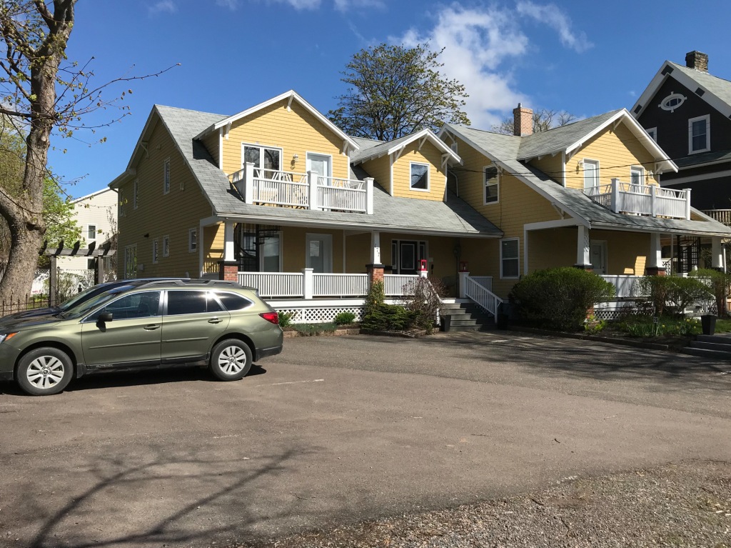
Alas, we did not stay at The Great George Hotel, but we had excellent accommodations a few blocks away from Province House at Cranford House, pictured below with our car, part of the Fairholm Inn properties.


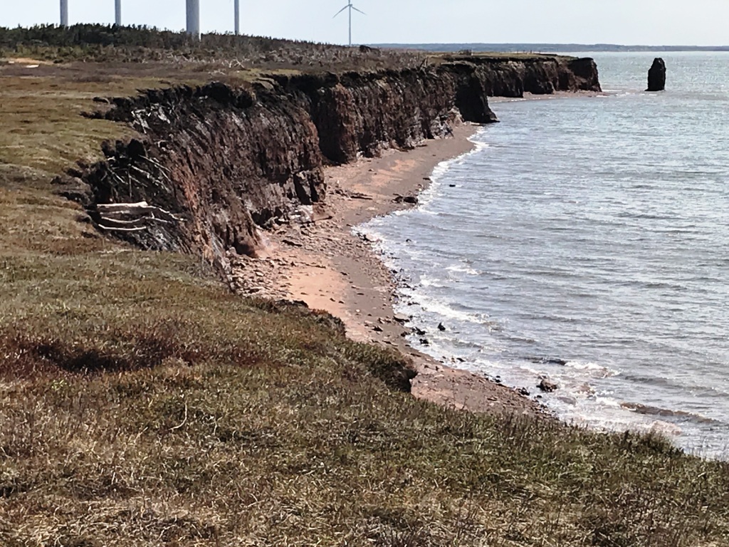
Prince Edward Island is the smallest Canadian province. It is approximately one quarter the size of Vermont in both area and population. Nearly half the population of PEI lives in the Charlottetown metro area, yet the central city is compact and very walkable. The city is located on Charlottetown Harbor which opens onto Hillsborough Bay which in turn opens onto the Northumberland Strait between PEI and the mainland (New Brunswick and Nova Scotia). There is a pleasant boardwalk along Charlottetown Harbor:


One of the fun things we did in Charlottetown was to follow the trail of Eckhart the Mouse, starting at the Visitor Information Centre on the waterfront which had a brochure about the trail. This news article from 2009 provides interesting background about the trail.

Friday, May 25, 2018

Cavendish


Today we visited the Cavendish section of PEI National Park, and other points west of Dalvay.

The amenities at Cavendish Beach were not yet open for the season, but the Cavendish Dunelands Trail was open. Like the Greenwich Dunes Trail which we hiked yesterday, there was a new floating boardwalk across a pond. The photo below shows the pond to the right of the dunes and the ocean on the left:


Cavendish Beach is west of Rustico Bay. Later in the day, we drove around to the east side of Rustico Bay and hiked some of the trails on Robinsons Island. Below Nancy is relaxing at a lookout over the bay:


From this lookout we saw a pair of bald eagles in the trees, and a raccoon fishing for food in the bay. We also saw a red fox and a snowshoe hare in our travels today. All relatively close.

The Robinsons Island Trail System was unique in our travels. This trail is for both hikers and mountain bikers. It includes 12 technical trail challenges for the latter – rollers, pump tracks, teeter totters, and wood and rock bridges, as well as a bicycle repair station with tethered tools and an air pump. The R.I.T.S., the floating boardwalks, and several of the outlooks on the trails were all new. I would guess that they were built last year.

Today we drove portions of the Central Coastal Drive. This scenic drive is divided into two sections – the Green Gables Shore (north shore) and the Red Sands Shore (south shore). We were on the north shore. The reason it is called the Green Gables Shore is because of this house in Cavendish:


I'll have more to say in a later post about this famous house with green gables.

One of our interesting stops today, outside of PEI National Park, was in Rustico. This town on Rustico Bay is the oldest Acadian settlement on Prince Edward Island, and it is the home of the historic Farmers' Bank of Rustico:


From a sign in front of the building:
A symbol of Acadian survival, The Farmers' Bank of Rustico operated from 1864 to 1894 and was the precursor of the credit union movement in North America.

The building is now a museum, but it was not yet open for the season. The church in the background in the photo above is St. Augustine's Church. From the same sign:
A pro-cathedral built in 1838 by Acadian craftsman, St. Augustine's is the oldest Roman Catholic church still in use on Prince Edward Island. Three tower bells, cast in Sheffield, England, were added during the tenure of Father Belcourt, who also founded The Farmers' Bank of Rustico. Visitors are welcome!

The church was open; there was a funeral in process. We did not visit.

Although we did not tour any buildings, we walked about 200 yards down to the water where we had a close-up view of mussel farming in Rustico Bay:


Thursday, May 24, 2018

Greenwich


Today we visited the Greenwich section of PEI National Park, and other points east of Dalvay.

The Greenwich Interpretation Centre and Greenwich Beach were closed, but the Greenwich Dunes Trail was open. The trail crosses Bowley Pond on a new floating boardwalk:


The trail leads to the parabolic Greenwich Dunes and the coast:


We drove portions of the scenic Points East Coastal Drive today. The photo below is a recently plowed and seeded field on the southern edge of St. Peters Bay:


The bay itself was also being actively farmed – for mussels. From the sign at the lookout:
The Bay is dotted with rows of buoys suspending mussel socks filled with cultured P.E.I. Blue Mussels.

We saw many fields like this being tilled or planted in a rotation of potatoes, grain, and hay. And we saw many bays like this being farmed for either mussels or oysters. Potatoes, mussels, and oysters were all tasty.

The photo below is from the east coast of Prince Edward Island, near Sally's Beach Provincial Park (which was closed):


Wednesday, May 23, 2018

Dalvay


Our first three nights on Prince Edward Island were in Dalvay, where we stayed at Dalvay By The Sea:


This historic property was built in 1895 as a summer home by Alexander MacDonald:
a wealthy businessman and one-time president of Standard Oil Company with John D. Rockefeller. He named the house “Dalvay By The Sea” after his boyhood home in Scotland.

Dalvay By The Sea is now a 25-room hotel in Prince Edward Island National Park and a national historic site.

We arrived on May 23 and went for a walk on Dalvay Beach:


It was 43°F, windy, and starting to rain. We did not stay on the beach for long.

The weather improved after that first day. The inn was a short walk from the ocean, visible over the dunes in this view on a later day from our second floor room:


Dalvay By The Sea reminded me of New England's historic "grand hotels." The accommodations were comfortable, especially the common areas, but the real treat was the food. Below was breakfast one morning – granola and yogurt, and French toast, both with fruit.


Prince Edward Island National Park includes several different sections along the north shore of PEI, with Dalvay about in the middle. We explored the park from our base here, as discussed in the next two posts. The park was not fully open for the season (no entrance fee!), and not all areas or attractions were open, but we were able to enjoy significant portions of the park. And we had the place almost to ourselves. It was clear that this is a popular park, and that there would be crowds of tourists later in the summer, especially since the Canadian government is currently upgrading many sections of the park. We saw many recent improvements, and considerable construction in progress.

Bridges


Our destination on this vacation was Prince Edward Island. Not long ago PEI was reachable only by boat or airplane, but today we drove from New Brunswick to PEI across the Confederation Bridge, built in 1993-1997, shown above from the New Brunswick side. The eight-mile long Confederation Bridge (Wikipedia, homepage) is the longest bridge in the world that crosses ice-covered water.

Before I leave New Brunswick and start blogging about Prince Edward Island, there is more to be said about bridges. I was pleasantly surprised to learn that New Brunswick, like Vermont, has a rich heritage of wooden covered bridges. We visited three covered bridges near Alma, New Brunswick, on the Bay of Fundy, where we stayed for two nights.

The bridge below is the Shepody River #3 covered bridge on Midway Road off Route 114 north of Alma:


The bridge below is the Sawmill Creek #5 covered bridge next to Route 114 north of Alma:


The bridge below is the Point Wolfe covered bridge in Fundy National Park west of Alma:


We drove through the Shepody River and Point Wolfe bridges. The Sawmill Creek bridge is no longer in service for automobiles, but is part of a trail system.

The Pointe Wolfe bridge is within sight of the Bay of Fundy, and the Point Wolfe River is a tidal river. This bridge must be one of the few wooden covered bridges in the world where salt water and fresh water mix under the bridge. From 1826 to 1921 there was an operating sawmill and dam adjacent to this bridge. These were removed following the establishment of Fundy National Park in 1948.

More information about covered bridges in New Brunswick: Government NB, Tourism NB, a personal blog, another personal blog.

Finally, I was interested to see a modern covered pedestrian bridge in Moncton, 50 miles north of Alma, albeit not a wooden covered bridge:


The bridge is over a tributary of the Petitcodiac River, and the red bank in the photo above is the bank of the Petitcodiac. The trail through the bridge is part of the Riverfront Trail, which in turn is part of The Great Trail (formerly called the Trans Canada Trail).

The map below shows the locations of the Confederation Bridge, Alma, and Moncton.


Tuesday, May 22, 2018

Hopewell Rocks


The Bay of Fundy between New Brunswick and Nova Scotia claims the highest tides in the world, exceeding 50 feet. The Hopewell Rocks are far up the bay on the New Brunswick side. These rock columns, also called the Flowerpot Rocks, were once part of the mainland but tidal erosion has worn away the shore. We visited the Hopewell Rocks today, and walked among the rocks at low tide.


The tide covers the base of the rock columns twice daily, and erosion is constant. Within the last few decades, existing columns have collapsed and new columns have formed.

We did not stay for high tide, when one can kayak between the rocks. The YouTube page for the Hopewell Rocks Provincial Park has several time-lapse videos of the rocks through an entire tide cycle. Follow the link for "Site Videos":

http://www.youtube.com/hopewellrocks1

As shown in the videos, the water in the upper Bay of Fundy is muddy. From a sign at the park:
The Bay's rich red mud flats are built up from an accumulation of silt carried by the tides from the sandstone cliffs. The sandstone contains iron that has been oxidized (exposed to air) which results in the brick red colour of the rocks. The Bay's famous chocolate-coloured water is the result of the constant movement of water over the Bay's mud flats, which does not allow the sediments to settle.

That sign was overlooking a mud flat just around the corner from the photos above. We also walked there while the tide was out:


From the same sign:
The mud flats that are seen from this viewing deck play an important part in the Bay of Fundy's diverse ecosystem. To the unsuspecting eye they are simply part of Fundy's unique and colorful landscape. However, to thousands of migrating shorebirds that visit the Hopewell Rocks each year, these mud flats are home to one of its most important inhabitants. Burrowed beneath the oozy, red mud are tiny mud shrimp that serve as food, and in turn, fuel for migrating shorebirds.

The migrating birds stop at Hopewell Rocks in mid-July to mid-August on their flight from the Artic to South America, so we were not there at the right time of year to see them (but we did see a pair of nesting peregrine falcons). Click here for more information about the migrating shorebirds.

The mud flat pictured above is called Demoiselles Beach. Also from the same sign:
The name 'Desmoiselles' refers to the cape, creek and beach in this area, and is attributed to early French explorers. Upon seeing the unique shapes of the rocks, with their distinctive flowerpot canopies, the French were reminded of shapely women wearing elaborate hats; thus the name 'Cap de Demoiselles' or 'Cape of Maidens'.