
The Bay of Fundy between New Brunswick and Nova Scotia claims the highest tides in the world, exceeding 50 feet. The Hopewell Rocks are far up the bay on the New Brunswick side. These rock columns, also called the Flowerpot Rocks, were once part of the mainland but tidal erosion has worn away the shore. We visited the Hopewell Rocks today, and walked among the rocks at low tide.

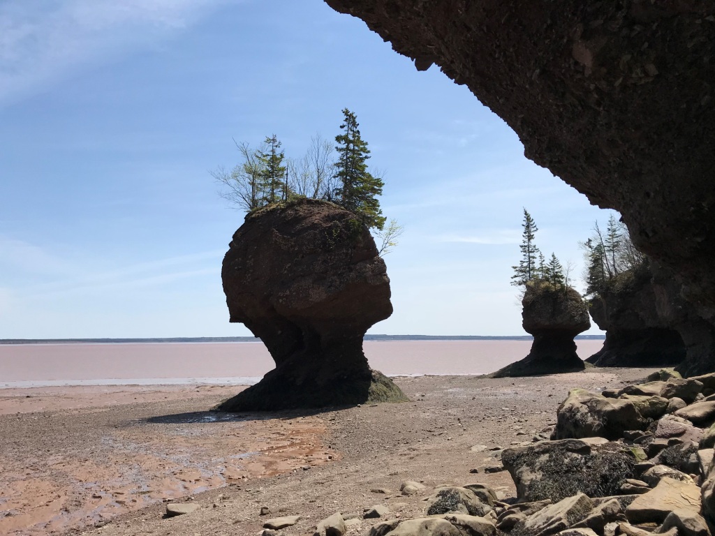

The tide covers the base of the rock columns twice daily, and erosion is constant. Within the last few decades, existing columns have collapsed and new columns have formed.
We did not stay for high tide, when one can kayak between the rocks. The YouTube page for the Hopewell Rocks Provincial Park has several time-lapse videos of the rocks through an entire tide cycle. Follow the link for "Site Videos":
http://www.youtube.com/hopewellrocks1
As shown in the videos, the water in the upper Bay of Fundy is muddy. From a sign at the park:
The Bay's rich red mud flats are built up from an accumulation of silt carried by the tides from the sandstone cliffs. The sandstone contains iron that has been oxidized (exposed to air) which results in the brick red colour of the rocks. The Bay's famous chocolate-coloured water is the result of the constant movement of water over the Bay's mud flats, which does not allow the sediments to settle.
That sign was overlooking a mud flat just around the corner from the photos above. We also walked there while the tide was out:

From the same sign:
The mud flats that are seen from this viewing deck play an important part in the Bay of Fundy's diverse ecosystem. To the unsuspecting eye they are simply part of Fundy's unique and colorful landscape. However, to thousands of migrating shorebirds that visit the Hopewell Rocks each year, these mud flats are home to one of its most important inhabitants. Burrowed beneath the oozy, red mud are tiny mud shrimp that serve as food, and in turn, fuel for migrating shorebirds.
The migrating birds stop at Hopewell Rocks in mid-July to mid-August on their flight from the Artic to South America, so we were not there at the right time of year to see them (but we did see a pair of nesting peregrine falcons). Click here for more information about the migrating shorebirds.
The mud flat pictured above is called Demoiselles Beach. Also from the same sign:
The name 'Desmoiselles' refers to the cape, creek and beach in this area, and is attributed to early French explorers. Upon seeing the unique shapes of the rocks, with their distinctive flowerpot canopies, the French were reminded of shapely women wearing elaborate hats; thus the name 'Cap de Demoiselles' or 'Cape of Maidens'.
No comments:
Post a Comment